Real-Time Dam Levels
Across Australia

Track water storage, capacity and historical trends for major reservoirs in New South Wales, Victoria, Queensland and beyond.

57.3% National average
303 Dams tracked
87,729 GL Total capacity
06 Jun 2026 Last Updated
Fitzroy Barrage Water Level

Fitzroy Barrage Water Level

Queensland · Unknown
Reviewed by Water Resources Analyst
Hydrological Summary: Fitzroy Barrage currently stores 99.4% of its total 81 GL capacity. Located in QLD and operated by Rockhampton Regional Council, it is a critical water source for regional supply and irrigation.
Data officially sourced and updated from Queensland water authorities. Last dataset update: 2026-06-02 12:00:00
Current Storage Level 99.4%
Total Capacity
81 GL
Status
Normal / Safe
Operator
Rockhampton Regional Council
Last Updated
02 Jun 2026
Live Weather
13°C Clear sky
Rain: 0mm | Hum: 58%

Water Level Analysis

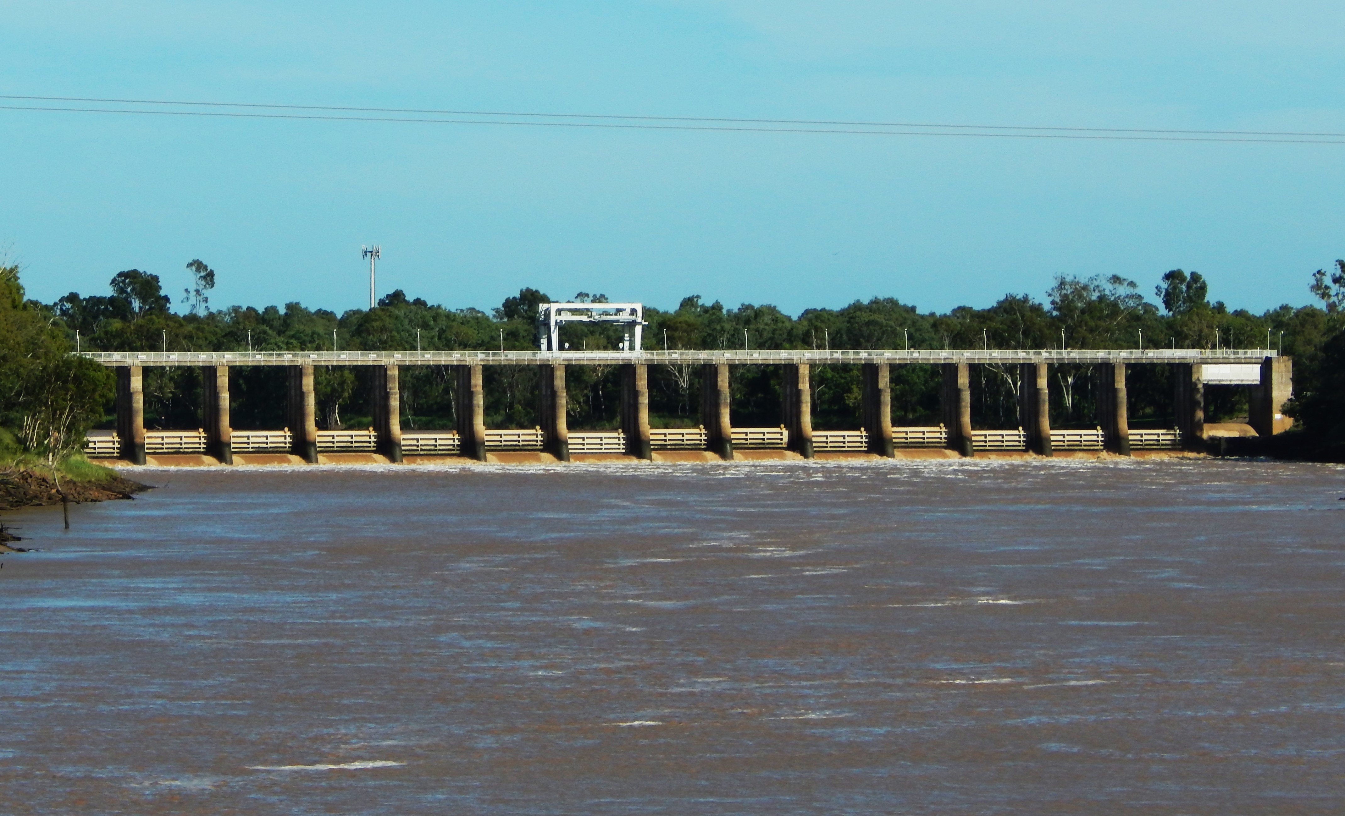
Reservoir storage at Fitzroy Barrage is near full capacity. With current readings at 99.4%, the reservoir holds a robust 81 GL. This provides immense water security for the Queensland region.

Catchment & Hydrological Impact

Fed primarily by the Fitzroy River, this reservoir plays a critical role in the North East Coast drainage division. Managing the flow from the Fitzroy River ensures that downstream agricultural zones receive consistent supply. Catchment dynamics in the North East Coast are deeply influenced by the retention capacity of Fitzroy Barrage.

Agricultural & Economic Significance

Agriculture in the surrounding areas of Queensland depends heavily on the water security provided by Fitzroy Barrage. Farmers and agribusinesses monitor these levels closely to plan their seasonal crop yields. Sustainable water management here ensures that both crops and livestock can survive prolonged dry spells.

Ecological & Recreational Context

The surrounding catchment of Fitzroy Barrage also supports diverse local flora and fauna. When capacity allows, Fitzroy Barrage becomes a hub for regional tourism and water sports. Authorities must constantly balance the need for human water consumption with the ecological necessity of maintaining healthy river systems downstream.

Current Weather & Evaporation Impact

Cooler current temperatures of 13°C help minimize evaporation losses across the reservoir. Currently experiencing clear sky conditions with no immediate precipitation, inflows remain entirely dependent on upstream river movement.

Future Outlook & Monitoring

The Bureau of Meteorology's climate outlooks will play a pivotal role in predicting the future inflows for this catchment. Continuous telemetry and advanced hydrological modeling are employed to forecast storage changes. Given the unpredictable nature of Australia's climate, from La Niña flooding to El Niño droughts, maintaining a dynamic operational strategy for Fitzroy Barrage is absolutely essential.

Location Map

Frequently Asked Questions

What is the current water level of Fitzroy Barrage?
As of the latest official reading, the water level at Fitzroy Barrage is at 99.4% of its total capacity.
Is Fitzroy Barrage currently full?
Yes, Fitzroy Barrage is virtually full at 99.4%.
What is the maximum water capacity of Fitzroy Barrage?
When completely full (100%), Fitzroy Barrage can hold up to 81 Gigalitres (GL) of water.
Where is Fitzroy Barrage located?
This reservoir is a critical water storage facility located in the state of Queensland, Australia.
How does the water level at Fitzroy Barrage affect local agriculture?
Water levels dictate the irrigation allocations for surrounding farmlands. A healthy level of 99.4% ensures that local farmers have the necessary water security for their seasonal crops and livestock.
Who manages the data for Fitzroy Barrage?
The data is sourced from official government authorities including the Bureau of Meteorology (BOM) and specific state water utilities.

Nearby Dams in Queensland

Largest Reservoirs in Queensland

Latest Water & Drought News

← Back to all dams