Real-Time Dam Levels
Across Australia

Track water storage, capacity and historical trends for major reservoirs in New South Wales, Victoria, Queensland and beyond.

57.3% National average
303 Dams tracked
87,729 GL Total capacity
06 Jun 2026 Last Updated
Lake Augusta Water Level

Lake Augusta Water Level

Tasmania · South Esk Great Lake
Reviewed by Water Resources Analyst
Hydrological Summary: Lake Augusta currently stores 9.3% of its total 24 GL capacity. Located in TAS and operated by Hydro Tasmania, it is a critical water source for regional supply and irrigation.
Data officially sourced and updated from Tasmania water authorities. Last dataset update: 2026-06-04 00:00:00
Current Storage Level 9.3%
Total Capacity
24 GL
Status
Normal / Safe
Operator
Hydro Tasmania
Last Updated
04 Jun 2026
Live Weather
5°C Partly cloudy
Rain: 0mm | Hum: 78%

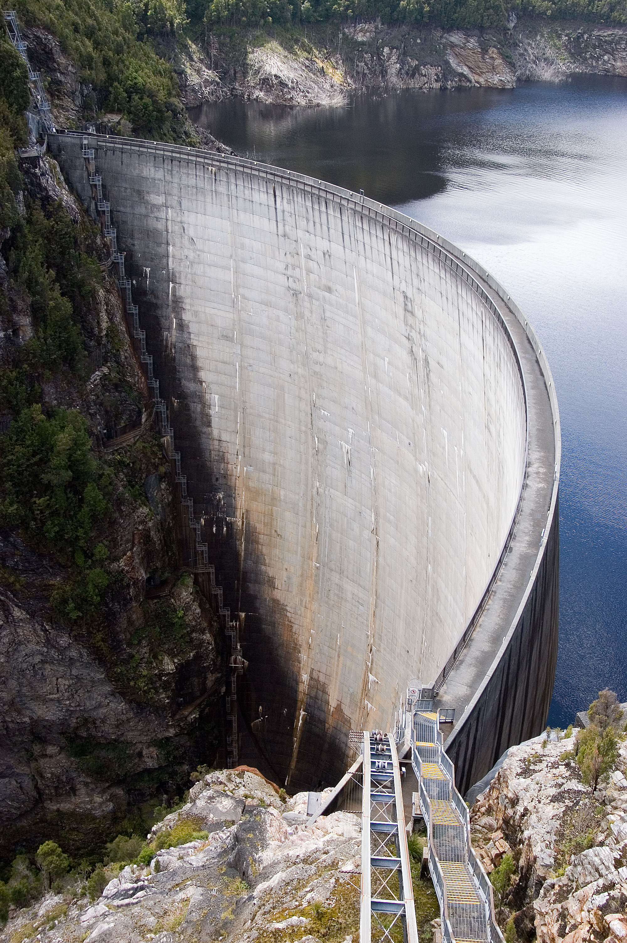
Water Level Analysis

Lake Augusta is currently facing severe depletion. Sitting at a mere 9.3% of its 24 GL total capacity, extreme conservation measures may be required. Extended drought conditions or lack of significant inflows into the catchment are likely the primary drivers of this severe depletion.

Catchment & Hydrological Impact

Fed primarily by the Ouse River, this reservoir plays a critical role in the Tasmania drainage division. Hydrological health in this specific drainage basin is vital for downstream ecosystems. The Tasmania region relies heavily on the seasonal inflows captured here.

Agricultural & Economic Significance

Beyond standard municipal supply, Lake Augusta is a vital asset for the regional agricultural economy in Tasmania. Irrigation allocations are directly tied to these storage metrics. Without the buffer provided by this massive 24 GL storage, regional farming would face extreme volatility.

Ecological & Recreational Context

The surrounding catchment of Lake Augusta also supports diverse local flora and fauna. When capacity allows, Lake Augusta becomes a hub for regional tourism and water sports. However, environmental flow releases must be carefully balanced to protect downstream river health.

Current Weather & Evaporation Impact

Cooler current temperatures of 5°C help minimize evaporation losses across the reservoir. Currently experiencing partly cloudy conditions with no immediate precipitation, inflows remain entirely dependent on upstream river movement.

Future Outlook & Monitoring

Looking ahead, the trajectory of Lake Augusta's water levels will depend heavily on upcoming seasonal rainfall patterns. State water authorities utilize highly sophisticated monitoring tools to ensure every drop is accounted for. Resilience against extreme weather events remains the ultimate goal for the managers of this critical infrastructure.

Location Map

Frequently Asked Questions

What is the current water level of Lake Augusta?
As of the latest official reading, the water level at Lake Augusta is at 9.3% of its total capacity.
Is Lake Augusta currently full?
No, it is currently experiencing low water levels at 9.3%.
What is the maximum water capacity of Lake Augusta?
When completely full (100%), Lake Augusta can hold up to 24 Gigalitres (GL) of water.
Where is Lake Augusta located?
This reservoir is a critical water storage facility located in the state of Tasmania, Australia.
How does the water level at Lake Augusta affect local agriculture?
Water levels dictate the irrigation allocations for surrounding farmlands. A healthy level of 9.3% ensures that local farmers have the necessary water security for their seasonal crops and livestock.
Who manages the data for Lake Augusta?
The data is sourced from official government authorities including the Bureau of Meteorology (BOM) and specific state water utilities.

Nearby Dams in Tasmania

Largest Reservoirs in Tasmania

Latest Water & Drought News

← Back to all dams