Real-Time Dam Levels
Across Australia

Track water storage, capacity and historical trends for major reservoirs in New South Wales, Victoria, Queensland and beyond.

57.3% National average
303 Dams tracked
87,729 GL Total capacity
06 Jun 2026 Last Updated
Dartmouth Water Level

Dartmouth Water Level

Victoria · Murray
Reviewed by Water Resources Analyst
Hydrological Summary: Dartmouth currently stores 65.5% of its total 3,856 GL capacity. Located in VIC and operated by Goulburn-Murray Water, it is a critical water source for regional supply and irrigation.
Data officially sourced and updated from Victoria water authorities. Last dataset update: 2026-06-04 00:00:00
Current Storage Level 65.5%
Total Capacity
3,856 GL
Status
Normal / Safe
Operator
Goulburn-Murray Water
Last Updated
04 Jun 2026
Live Weather
5°C Partly cloudy
Rain: 0mm | Hum: 99%

Water Level Analysis

Dartmouth is currently exhibiting average water retention levels. The current reading shows the reservoir at 65.5%, translating to 3,856 GL. Authorities continue to monitor inflows carefully.

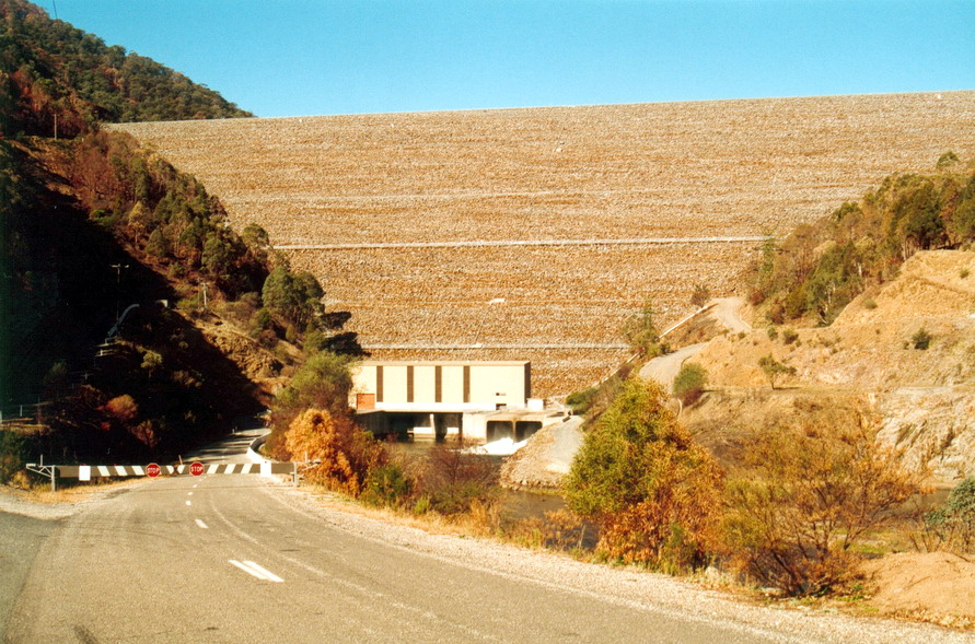
Catchment & Hydrological Impact

The Mitta Mitta River acts as the primary lifeblood for Dartmouth, making it a cornerstone of the Murray-Darling Basin network. Hydrological health in this specific drainage basin is vital for downstream ecosystems. Catchment dynamics in the Murray-Darling Basin are deeply influenced by the retention capacity of Dartmouth.

Agricultural & Economic Significance

Beyond standard municipal supply, Dartmouth is a vital asset for the regional agricultural economy in Victoria. Irrigation allocations are directly tied to these storage metrics. Without the buffer provided by this massive 3,856 GL storage, regional farming would face extreme volatility.

Ecological & Recreational Context

The surrounding catchment of Dartmouth also supports diverse local flora and fauna. When capacity allows, Dartmouth becomes a hub for regional tourism and water sports. Authorities must constantly balance the need for human water consumption with the ecological necessity of maintaining healthy river systems downstream.

Current Weather & Evaporation Impact

With a mild reading of 5°C today, surface evaporation is significantly reduced, helping to preserve current volume. Currently experiencing partly cloudy conditions with no immediate precipitation, inflows remain entirely dependent on upstream river movement.

Future Outlook & Monitoring

Looking ahead, the trajectory of Dartmouth's water levels will depend heavily on upcoming seasonal rainfall patterns. Continuous telemetry and advanced hydrological modeling are employed to forecast storage changes. Resilience against extreme weather events remains the ultimate goal for the managers of this critical infrastructure.

Location Map

Frequently Asked Questions

What is the current water level of Dartmouth?
As of the latest official reading, the water level at Dartmouth is at 65.5% of its total capacity.
Is Dartmouth currently full?
It is partially full, currently holding steady at 65.5%.
What is the maximum water capacity of Dartmouth?
When completely full (100%), Dartmouth can hold up to 3,856 Gigalitres (GL) of water.
Where is Dartmouth located?
This reservoir is a critical water storage facility located in the state of Victoria, Australia.
How does the water level at Dartmouth affect local agriculture?
Water levels dictate the irrigation allocations for surrounding farmlands. A healthy level of 65.5% ensures that local farmers have the necessary water security for their seasonal crops and livestock.
Who manages the data for Dartmouth?
The data is sourced from official government authorities including the Bureau of Meteorology (BOM) and specific state water utilities.

Nearby Dams in Victoria

Largest Reservoirs in Victoria

Latest Water & Drought News

← Back to all dams